
| GEO235 Geographic Information Systems |
|
Lecturer:
Maria Attard
Value: 2 Credits
The aim of this credit is to understand the processes of handling and analysing geographical data. Lectures, practical exercises and a rich vein of paper and web-based learning resources support this credit. Web resources are crucial to this credit since most of the up-to-date material is found on the web. The suggestion therefore is to research the web for resources to support your progress through this credit. A successful candidate will be one who is able to combine their understanding of a lecture, the increased depth of knowledge achieved from the ancillary resources and their experience gained in the practical exercises.
For
the lastest news and updates!!
click
here
| Course Structure | Course Notes | Reading List | WWW Links | Student's Projects | Contact |
Introduction
These sessions set
out the scope of the topic and provide general reading material to understand
the basic concepts of a G.I.S. and learn about the development or history of
this technology.
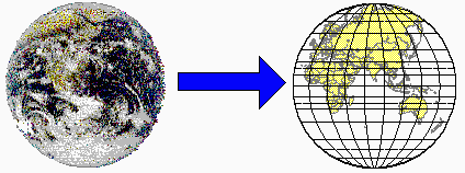
Map Projections
One key to understanding
G.I.S. is to understand its origins, Cartography and problems of flattening
the curved surface of the earth.
Spatial Data
Data in G.I.S. is fundamental.
But not all data is good. Data with a spatial element is needed. This section
provides information regarding spatial data vs non-spatial data, collection,
and converting and inputting data.
Spatial Data Modelling
Data is generally manipulated,
stored, managed and printed in the forms of maps. This requires other key elements
of G.I.S. hardware and different types of image processing.
Digital
Terrain Models (D.T.M.)
There are various ways in
which data could be analysed and presented. In some cases, 3D modelling is required.
This section deals with the uses, advantages and disadvantages of D.T.M's.

Applied
G.I.S.
The key to success in using
and implementing G.I.S. is visualising its full potential and identify applications
where the software could be used.
Practical Applications
Using spatial and non-spatial
data, the practical sessions will focus on the basic elements in using a G.I.S.,
such as collection and data input, digitizing, map production and analysis.
The software used in the G.I.S. Lab is Arcview 3.1. More information regarding
the software is available on the ESRI website.

Course notes will be available on this page shortly.
Bugayevskiy,
L.M. & Snyder, J.P. (1995) Map Projections A Reference Manual Taylor and
Francis.
Burrough, P.A. (1986) Principles of Geographical
Information Systems for Land Resources Assessment Oxford.
Burrough, P.A. & McDonnell, R.A. (1998)
Principles of Geographical Information Systems Oxford.
Clarke, K.C. (1997) Getting Started with
Geographic Information Systems Prentice Hall.
Kraak, M.J. & Ormeling, F.J. (1996)
Cartography Visualization of Spatial Data Longman.
Laurini, R. (2001) Information Systems for
Urban Planning A hypermedia co-operative approach Taylor and Francis
Longley, P., Goodchild, M.F., Maguire D.J.
& Rhind, D.W. (2001) Geographic Information Systems. Systems and Science
Wiley
Maguire, D.J., Goodchild, M.F. & Rhind,
D.W. (1991) Geographical Information Systems Principles and Applications Longman.
Available online at http://www.wiley.com/legacy/wileychi/gis/resources.html
McDonnell,
R. and Kemp, K. (1995) International GIS Dictionary John Wiley and Sons
Mitchell, A. (1999) The ESRI Guide to GIS
Analysis Volume 1. Geographic Patterns and Relationships ESRI
Press
Muehrcke, P.C. & Muehrcke, J.O. (1992)
Map Use Reading - Analysis - Interpretation JP Publications.
Worboys, M.F. (1995) GIS A Computing Perspective
Taylor and Francis.
The list of www links on GIS is endless. The ones below provide a start into the world of GIS on the web. Web based information regarding GIS is essential as the technology is fast developing and regular updates, especially regarding software development and applicability are a must. Much information is found on the Internet, and apart from the journals on GIS, the web is the most effective tool to find up-to-date information.
http://www.wiley.com/legacy/wileychi/gis/resources.html
(The GIS 'Big Book' online)
http://www.casa.ucl.ac.uk/
http://www.esri.com
(with special reference to the annual conference proceedings and esri virtual
campus)
http://mapinfo.com
http://www.geocom.com/
http://www.geographynetwork.com/
http://www.usgs.com
http://www.ncgia.ucsb.edu/ncgia.html
http://www.geo.ed.ac.uk/home/giswww.html#H
http://www.erdas.com/
http://www.bts.gov/gis/
http://www.GeoPlace.com/
http://www.ermapper-spain.com/
http://www.geospatial-online.com/
http://www.geog.uni-hannover.de/grass/index2.html
http://www.colorado.Edu/geography/gcraft/notes/mapproj/mapproj_f.html
http://www.regis.berkeley.edu/
http://www.geo.ed.ac.uk/home/research/whatisgis.html
http://hum.amu.edu.pl/~zbzw/glob/glob1.htm
http://www.gisruk.co.uk

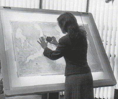
A gallery of maps will shortly be available in this section, all produced by students taking the introductory course in GIS. These projects involved all the processes of data collection, input by digitising and analysis.
For information on the use of the lab facilities contact CSC reception on support@csc.um.edu.mt or mbona@gis.um.edu.mt
To attend any of the lectures
provided or wish information on how to use GIS for any particular project please
contact the course convenor Maria
Attard on mbona@gis.um.edu.mt