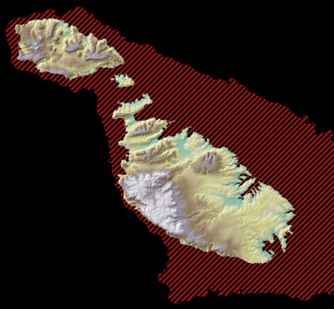
MAPSCAPE (Mapping the submerged Quaternary landscape of the Maltese Islands)
The zone shaded in red represents the terrestrial landscape submerged since the Last Glacial Maximum.
Since the Last Glacial Maximum, at least 450 km2 of terrestrial landscape (150% of the present landmass of the Maltese Islands) have been drowned by eustatic sea level rise.
Most of this territory preserves valuable geological archives of paleo-environmental and climatic changes, as well as potential evidence of human activity and their response to a rapidly changing environment.
The objective of MAPSCAPE is to acquire marine geophysical data from Maltese waters between the shoreline and the 130 m isobath, and reconstruct the submerged Quaternary landscape of the Maltese Islands.
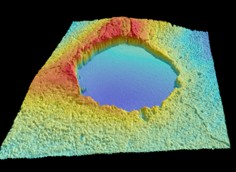
Submerged doline offshore the NE of Malta.
This project is being carried out in collaboration with the National Oceanography Centre, RPM Nautical Foundation and ISMAR. This research project is also part of COST Action TD0902 SPLASHCOS (Submerged Prehistoric Archaeology and Landscapes of the Continental Shelf), funded by the ESF through the EU RTD Framework Programme.
Micallef, A., Foglini, F., Le Bas, T., Angeletti, L., Huvenne, V. and Taviani, M. (2011) Reconstruction of the morphology and evolution of the submerged Quaternary landscape of the Maltese Islands, HERMIONE Annual Meeting 2011, Estepona, Spain.
Le Bas, T., Micallef, A. and Blondel, P. (2011) Use of texture analysis techniques for digital mapping of underwater environments: The case of a submerged karstic landscape offshore Malta, Geophysical Research Abstracts, 13.